Resource Library
Hawaii Prevents Wildfire 3rd-6th Grade Activity Book
Join Kaleo The Pueo in safeguarding Hawaii with our interactive activity book, offering engaging wildfire prevention activities for Kindergarten to 2nd grade students – print yours today!
Hawaii Prevents Wildfire K-2nd Grade Activity Book
Join Kaleo The Pueo in safeguarding Hawaii with our interactive activity book, offering engaging wildfire prevention activities for Kindergarten to 2nd grade students – print yours today!
Hawaii Prevents Wildfire Kaleo The Pueo Coloring Book
Join Kaleo The Pueo in protecting Hawaii from wildfires with our engaging coloring book featuring fun illustrations and valuable firewise tips - print yours today
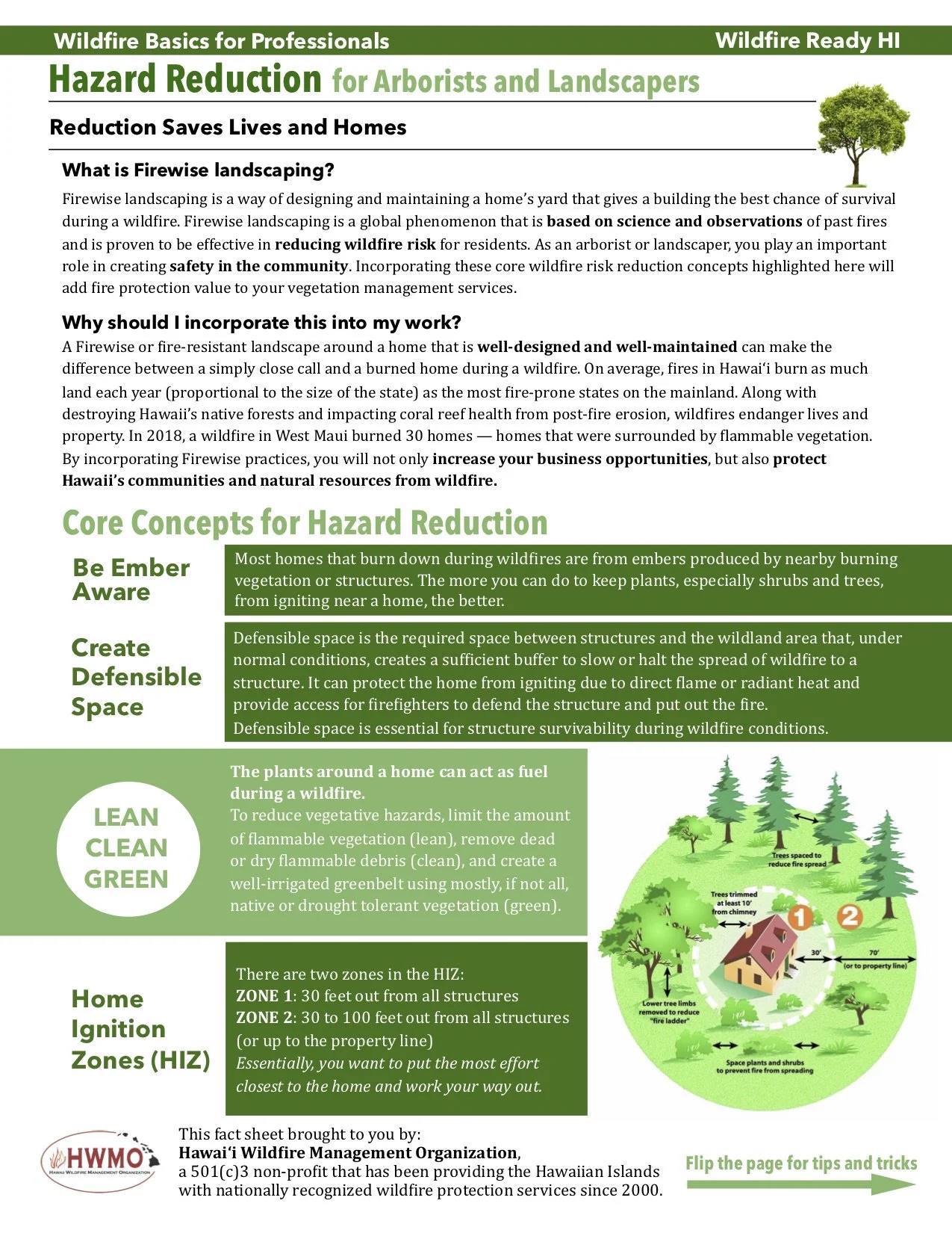
Hazard Reduction for Arborists and Landscapers
Discover Firewise landscaping techniques for arborists and landscapers to enhance community safety and reduce wildfire risk. Incorporate defensible space, ember awareness, and strategic plant spacing to safeguard homes and promote long-term resilience.
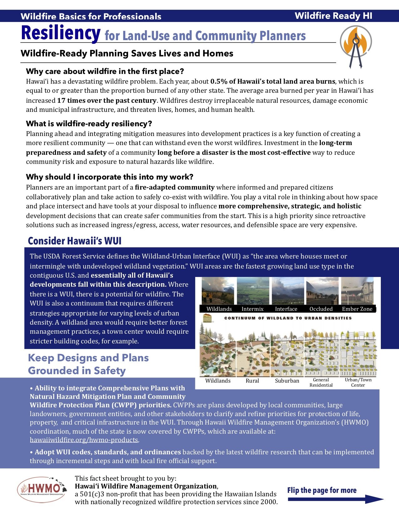
Resiliency for Land-Use and Community Planners
Download our two-page guide for land-use and community planners on integrating firewise strategies into long-term community resiliency planning, promoting safety and preparedness in high-fire-risk areas.
East Hawaii Island - Community Wildfire Hazard Assessments
HWMO, in collaboration with partners, conducted a comprehensive state-wide hazard assessment, focusing on the east side of Hawaii Island, to inform CWPPs and other fire management strategies with detailed hazard ratings.
North Hawaii Island - Community Wildfire Hazard Assessments
HWMO, alongside partners, conducted a comprehensive state-wide hazard assessment, which aids fire management strategies for Hawaii Island's north region and provides detailed data for CWPPs and future initiatives.
Southwest Hawaii Island - Community Wildfire Hazard Assessments
HWMO's island-wide hazard assessment, conducted with partners, informs fire management strategies for Hawaii Island's southwest region, guiding CWPPs and future initiatives with comprehensive data.
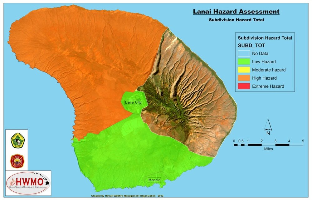
Lanai - Community Wildfire Hazard Assessments
HWMO and partners conducted island-wide hazard assessments, leveraging expert insights and site inspections to inform fire management strategies, particularly centeral Maui, guiding CWPPs and future initiatives.
Central Maui - Community Wildfire Hazard Assessments
HWMO and partners conducted island-wide hazard assessments, leveraging expert insights and site inspections to inform fire management strategies, particularly central Maui, guiding CWPPs and future initiatives.
East Maui - Community Wildfire Hazard Assessments
HWMO and partners conducted island-wide hazard assessments, leveraging expert insights and site inspections to inform fire management strategies, particularly in the eastern region of Maui, guiding CWPPs and future initiatives.
West Maui - Community Wildfire Hazard Assessments
HWMO, with partners, completed a comprehensive hazard assessment, utilizing site inspections and expert input, to guide fire management in Maui's western region and inform CWPPs and future initiatives.
Molokai - Community Wildfire Hazard Assessments
HWMO, in collaboration with partners, conducted island-wide hazard assessments, combining site inspections and expert input to provide detailed fire environment ratings, aiding CWPPs and future fire management efforts on Molokai.
Kauai - Community Wildfire Hazard Assessments
HWMO, along with dedicated partners, conducted a comprehensive hazard assessment across Kauai County, utilizing expert-driven site inspections and fire responder input to evaluate 36 criteria per area, guiding future fire management strategies.
2018-19 Rapid Assessment of Vegetation Management Results
Wildfire's escalating threat in Hawaii necessitates landscape-level vegetation management strategies, as evidenced by HWMO's collaborative initiatives and rapid mapping assessments to mitigate hazards and enhance community resilience.
Hawaii State Wildfire History Interactive Map - Geoportal
HWMO orchestrated a collaborative effort to establish statewide wildfire data, aiming to support community planning, research, funding, resource allocation, and preparedness in Hawaii.
Hawaii Wildfire Interactive Web App
The Hawaii Wildfire web app provides accessible wildfire information for residents, visitors, and stakeholders, aiding in understanding local hazards and facilitating community action.
State of Hawaii Wildfire History Map (1999-2022)
HWMO's decade-long effort in compiling and mapping Hawaii's fire history aids diverse stakeholders in understanding fire behavior patterns and informs strategic wildfire management decisions.
State of Hawaii Wildfire History Map (2002-2012)
Understanding fire behavior patterns in Hawaii aids various stakeholders, facilitated by HWMO's comprehensive fire history database, benefiting land managers, firefighters, communities, decision-makers, and scientists, enhancing wildfire management efforts and safety measures.
North Shore Oahu CWPP - 2021
CWPPs vital for Hawaii Island's wildfire defense. HWMO leads NW region updates for community safety.
